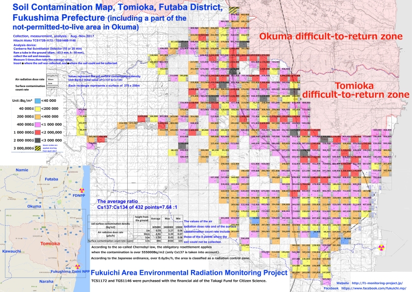
We are publishing the most recent map of the soil contamination made by the “Fukuichi area environmental radiation monitoring project“.
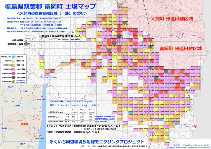
「ふくいち周辺環境放射線モニタリングプロジェクト」作成の最新の土壌汚染マップをアップいたします。
We are publishing the most recent map of the soil contamination made by the “Fukuichi area environmental radiation monitoring project“.
We have published several soil contamination maps of the “Fukuichi area environmental radiation monitoring project” in this blog (see maps of Namie, Minamisoma 1 & 2 ). Normally, the government should carry out the measurements, but the government relies on the air radiation dose measurements at the expense of the radio-contamination measurements found on the surface and in the air (in terms of the volume of radioactive substances). To fulfill the lack of this essential information for the radioprotection of the population, civil groups conduct soil measurements.
このブログで紹介してきた「ふくいち周辺環境放射線モニタリングプロジェクト」の土壌汚染マップですが(浪江町、南相馬市 1 & 2 )、もともと国や地方自治体が実施すべき測定です。しかし、政府は空間線量率の測定のみを優先し、表面(土壌を含む)や空間の汚染密度をニグレクトしています。そのため住民の放射線防護に不可欠の情報が欠如しています。この情報不備を補完するため、市民団体が測定を 実行しているのが現状です。
[…]
Read more.


