A drone designed to scan disaster sites and nuclear plants for signs of radiation has been jointly awarded the Royal Academy of Engineering’s ERA Foundation Entrepreneurs Award.
James MacFarlane and his winning team at the University of Bristol will use the £15,000 award to bring the design to market — they already have interested parties around the globe, including the UK’s own Sellafield plant. […]
“Our drone is really small and lightweight so can get very close to the ground,” MacFarlane told Wired.co.uk. “Usually you would have helicopters thousands of metres above the site capturing data that equates to 200-300m per pixel. We can detect down to around half a metre squared per pixel and create really high resolution maps that show where the radiation contamination is — either really low concentrations round nuclear sites or for areas where you’re trying to use it for hazard mapping to form escape routes.”
[…]
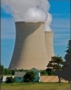
The design will also of course reduce the risks humans face when dealing with the aftermath of a disaster. At Fukushima, for instance, MacFarlane describes with some degree of incredulity how, for a time, monitoring included duct taping sensors to the front of buses and simply driving around. Data from the helicopter that scoured the site came later.
Read more.