東京電力は24日、東日本大震災に被災した福島第一原発敷地内の放射能汚染を示す地図を公開した。震災後の水素爆発で建屋が大きく壊れた1、3号機の周辺の空気中の放射線量が特に高く、爆発して1カ月以上たっても最大で毎時70ミリシーベルトの場所があった。敷地内の汚染の全容を示す初のデータだ。水素爆発で周辺に飛び散った放射性物質が原因と見られている。
続きは『原発1・3号機周辺、高汚染 水素爆発で飛散か』から。
東京電力は24日、東日本大震災に被災した福島第一原発敷地内の放射能汚染を示す地図を公開した。震災後の水素爆発で建屋が大きく壊れた1、3号機の周辺の空気中の放射線量が特に高く、爆発して1カ月以上たっても最大で毎時70ミリシーベルトの場所があった。敷地内の汚染の全容を示す初のデータだ。水素爆発で周辺に飛び散った放射性物質が原因と見られている。
続きは『原発1・3号機周辺、高汚染 水素爆発で飛散か』から。

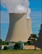
A nuclear power plant in Byron, Illinois. Taken by photographer Joseph Pobereskin (http://pobereskin.com).
The artwork in the header, titled "JAPAN:Nuclear Power Plant," is copyright artist Tomiyama Taeko.
The photograph in the sidebar, of a nuclear power plant in Byron, Illinois, is copyright photographer Joseph Pobereskin (http://pobereskin.com/)
This website was designed by the Center for East Asian Studies, the University of Chicago, and is administered by Masaki Matsumoto, Graduate Student in the Masters of Arts Program for the Social Sciences, the University of Chicago.
If you have any questions, please contact the Center for East Asian Studies, the University of Chicago at 773-702-2715 or japanatchicago@uchicago.edu.
