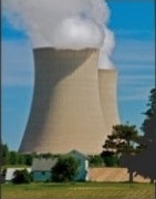
A small drone is to be deployed to measure radiation levels at the damaged reactors at Japan’s Fukushima Daiichi nuclear power plant. The UK-developed RISER – Remote Intelligence Survey Equipment for Radiation – has already been used successfully at Sellafield, in England.
[…]
After a series of on-site trials at Sellafield, RISER was put into decommissioning action. The drone has been used to collect vital information about conditions in the highly-contaminated Windscale Pile chimney. This data will be used to establish how the chimney can be cleaned out and finally dismantled.
RISER was first used inside one of the reactor buildings at Japan’s Fukushima-Daiichi plant several years ago, and is now set to return, mounted on the drone.
Read more.